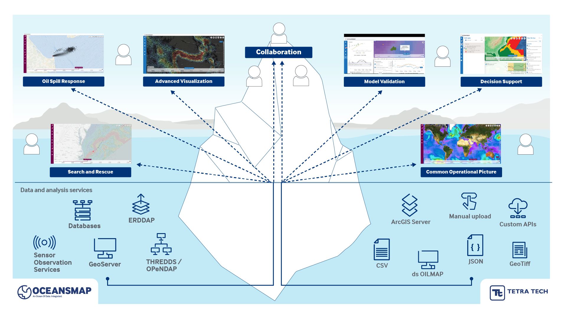
Data management, maritime planning, water quality, operational response - regardless of your application, OceansMap makes met-ocean data easy.
Learn more about the full range of innovative solutions and services from Tetra Tech Ocean Science.
The OceansMap platform can revolutionize met-ocean data management and visualization at a local and national scale by seamlessly integrating vast datasets and advanced analytics. It enables data access and informed decisions while promoting collaboration.
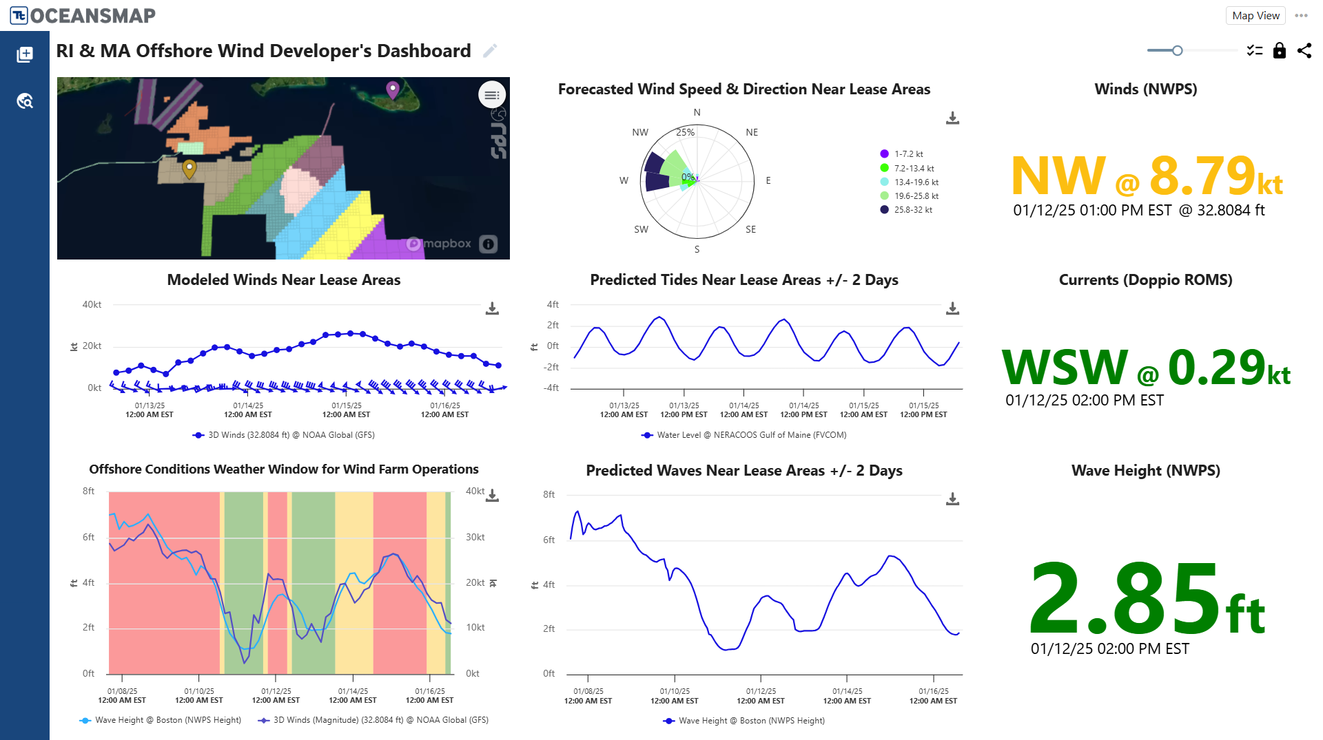
Operating in complex ocean environments means a breadth of planning, implementation, and operational challenges. Effectively navigating this complex network of challenges requires integrated software systems, like OceansMap, to ensure success.
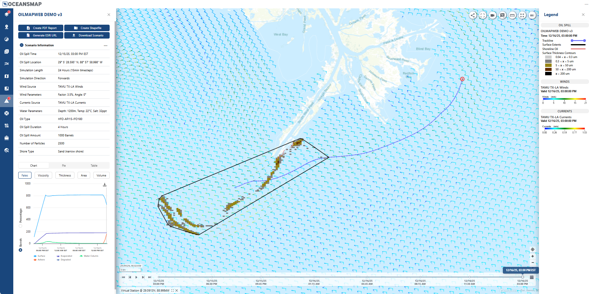
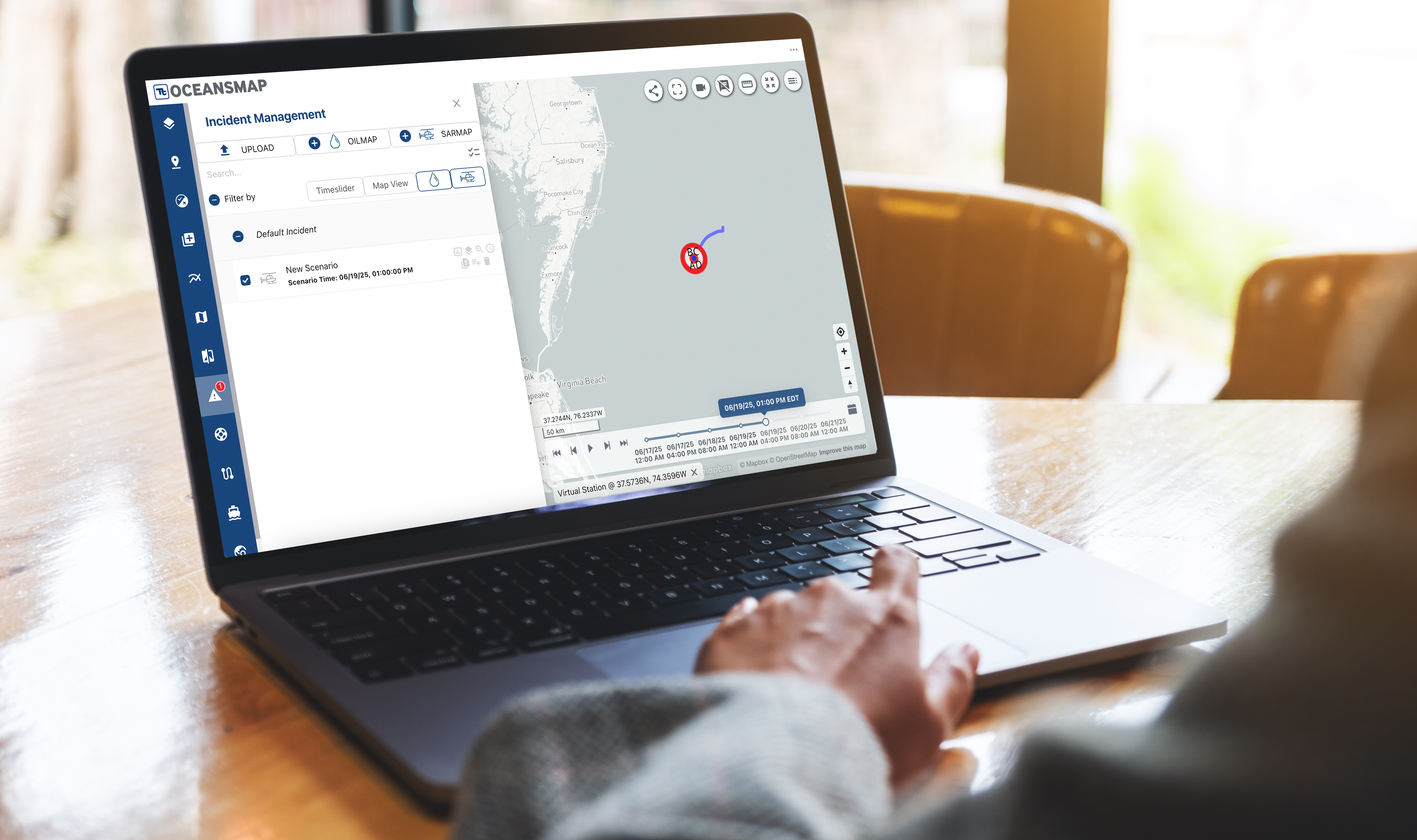
OceansMap elevates marine response capabilities by combining weather forecast and decision-making insights with advanced modeling tools like OILMAP and SARMAP. This integration enables swift and informed decisions, ensuring optimal outcomes.
OceansMap makes complex data easy. By integrating multi-disciplinary datasets, OceansMap improves environmental assessment and resilience. With accessible, actionable insights, it enhances environmental management, fostering resilience and sustainability for our planet's ecosystems.
At recreation facilities, near real-time observations and forecasts can enhance visitor enjoyment and improve safety. From event planning to daily activities, OceansMap can help optimize leisure time and enrich experiences.
Utilizing EDS, OceansMap can access global and regional public and propriety real-time and historic oceanographic, meteorological, and environmental data. EDS collects source data in disparate formats and processes it to improve the usability and standardize the format for visualization. This enables OceansMap to present a vast variety of data seamlessly integrated into a common operational picture.
OceansMap is a web based tool that provides industry leading met ocean data management, visualization and analysis capabilities used by marine operations specialists around the world.
It is a data ecosystem; behind the tool a collection of harvesters, processors, and services that brings together environmental data and forecasts from disparate sources, applies community standards, and ensures availability for visualization, analysis and decision support.
It includes a variety of tools to analyze data and create trajectory models enabling users to make informed decisions.
The OceansMap insights dashboard is a fully customizable visualization platform that can adapt to a user’s operational needs. Multiple dashboards can be created, saved, and shared by users to provide situational awareness at key locations and assets. Using a dashboard to present complex met-ocean data offers numerous benefits. The dashboard provides a consolidated view of essential metocean parameters and enables decision-makers to quickly assess the current conditions, identify trends, and understand the impact on their operations.
Our modeling tools have been developed over the past 40 years and are used by government and industry agencies globally for various operational use cases.
OILMAPWeb is a tool developed in the OceansMap framework that leverages our industry leading computational models and enables users to run and visualize oil spill trajectory and fate models. These tools provide operators with rapid trajectory outputs to aid response and improve outcomes.
SARMAP is an advanced, search and rescue system that provides rapid, reliable predictions of drifting objects and missing persons in marine, fresh water, and aeronautical environments, enabling efficient rescue operations in life-critical situations.
For more than 25 years, the SARMAP model has been used by Coast Guard agencies, Naval departments and international governments to successfully support search and rescue response, planning and drills/exercises in over 100 countries.